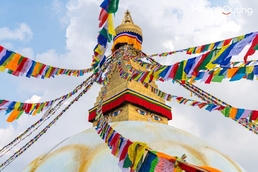
Mustang being a Nepalese region, is one of the prettiest and culturally rich Himalayan destinations. Situated slightly northward, the place is best recognized for its lovely scenic beauties, Buddhist culture, and spiritual places such as Muktinath, the key attraction. Many travelers from home and abroad come to Mustang yearly. Thus, with the ever-growing use of the smartphone and the internet, Google Maps has become an indispensable navigation app to reach this sleepy yet beautiful location.
We, in this article, will shed light on some working tips on using Google Maps while trekking through Mustang. These tips shall help make your journey smooth if you pursue exploring Jomsom, Kagbeni, and Muktinath.
- Download Offline Maps Before You Go
First and foremost, essential before traveling to Mustang is to download offline maps. Internet connectivity in Mustang, especially in the higher altitude areas like Muktinath, is slow or altogether absent. If you simply keep your survivability on live internet for Google Maps, you could be in for some navigation trouble.
Here’s how to download the offline map:
- Open Google Maps on your mobile phone.
- In the search bar, type “Mustang, Nepal”.
- Tap on the location located at the bottom.
- Click on “Download” to save it for offline use.
If offline directions are with you, it means you will have directions or see your location even if there is no mobile data or Wi-Fi.
- Understand the Terrain and Road Types
In Mustang, there exists all kinds of roads: from rough roads to mountain trails, to some newly-constructed highways up there. You may have experienced some time where Google Maps never displayed the actual condition of the roads. A route may appear to be short but it could really take forever because of landslides or rocky paths. Always check for the terrain type when seeking directions on Google Maps. If driving, switch to satellite or terrain view to check on elevation and road quality.
An example would be that from Jomsom to rendezvous Muktinath, one has a 20-mile track to cross-and yet it takes well over an hour and a half due to its poor condition and narrowness. So, having some knowledge of such roads would help you in your journey planning.
- Landmark Usage, Not Just Street Addresses
In a place like Mustang and in rural locations, small villages or hamlets cannot be accurately assigned either house numbers or proper addresses. Instead of looking for the address, go after the famous stops:
- Muktinath Temple
- Kagbeni Village
- Jomsom Airport
- Marpha Village
These landmarks are pretty well-marked in Google Maps and are easier to get to. If booking a Muktinath tour package from Gorakhpur, do ask your operator about the important stop points and some landmarks so that you can match them up on Google Maps.
- Check User Reviews and Photos
Google Maps also accommodates user reviews, ratings, and photos of many places around Mustang, India. So, when you decide to lodge at some guesthouse or dine in a local restaurant, go through the reviews and upload some photos for visual assistance on what to expect in terms of quality, cleanliness, and dining.
This feature is useful especially in finding places for food or overnight stays while on Nepal tour packages including Mustang as a destination. Usually, travelers express their own experiences, providing a far better picture than only directions.
- GPS Accuracy in Mountains
GPS works fine in Mustang, but, at times, it can show slight inaccuracies due to the terrain and deep valleys. Such instances could occur near narrow gorges or cliffs. The signal would bounce on the hills for a few minutes and would give wrong positions. Though Google Maps recalibrates pretty fast under most conditions, it still never hurts to carry a couple of paper maps or a guidebook.
Also, in any group travel or package tour, always follow the guide’s directives in case one finds any GPS to be contrary to local experience.
- Use Custom Pins and Labels
If you happen to be spending several days in Mustang, it will be convenient to save locations by pinning or labeling them. Using the “Save” feature on Google Maps, one may mark any number of hotel or other attractions, or even areas of interest. You may also create a list, say “Mustang Trip,” and add all the important places to that list. Then, when planning your daily routes, you don’t need to re-search every time.
This feature is pretty helpful for solo travelers or those who are experiencing Mustang independently and are thus not going through the usual Nepal tour packages.
- Check Weather and Travel Advisories
Mountain weather can be very unpredictable. Always check the weather before siding with a route on Google Maps. Google Maps sometimes alerts you for road blockages or weather conditions, but such updates may not be very frequent in the remote areas. Further consider looking at Windy app, AccuWeather, or the local travel forums to get the latest update.
If you’re booked on a Muktinath tour package from Gorakhpur, you could possibly get your tour guides to handle these updates for you. However, it’s best to keep track on your own side with Google or your travel apps in case you want to explore more on the side.
Final Thoughts
Google Maps is certainly an incredible powerhouse in traveling through the Mustang region of Nepal. However, this extraordinary landscape and connectivity issues put many limitations on its utility. Downloading offline maps; using some landmarks; checking terrain and weather will just add to the mix of enjoyment and safety down your journey, assisted by the digital tools and a bit of local advice.
Be it traveling alone or through well-organized Nepal tour packages, having some navigation help through Google Maps gives you that extra layer of convenience. And in case your trip starts far away, say, with a Muktinath tour package from Gorakhpur, then here go the directions from Plains of India to Himalayan Heights of Nepal!


